- Tangier Island, VA to Great Bridge, VA
- Great Bridge, VA to Columbia, NC
- Columbia, NC to Aurora, NC
October 19-21
First of all, I’ll just get my complaining out of the way right now. No, I’m not going to complain about the brown water, or waiting for draw bridges to open, or the monotonous yet stressful navigation of this LOOOOOOONG stretch of water. I am, of course, going to make a grammatical complaint. This 1,658 mile stretch of connected canals, bays, and rivers runs from New York to the west coast of Florida. It is called the Intracoastal Waterway, which should be abbreviated to the IW, not the ICW. Ok, I’m done. No more complaining, though most laypeople will wonder why I’m NOT complaining by the time I’m done describing the last three days.
We left Tangier Island like we were on fire. We are getting pretty antsy about getting to North Carolina so that we can start in on our long and growing list of boat projects before we leave for the Caribbean on or about November 4th. The wind was 15 knots and pushing us onto the dock, but Chris laid on the starboard bow thruster until we managed to push off, gunning it so that we wouldn’t crash into the pilings.
We headed into the CPB (I’m going to start calling the ChesaPeake Bay this just to drive home my point. Ridiculous, right?) and set a rhumb line for Hampton Roads, Virginia, the bay that encompasses Norfolk and Hampton. We planned on staying in Hampton for the night and starting the ICW the following day. We managed great time and hit Hampton Roads by 1500. We were tired from three days straight on the move, but we decided to push on and get some of the ICW under our belts. After all, we had to traverse 150 miles of it to get to Aurora, where my mom and Sal live. As soon as we made that decision, Chris went down below for something and we hit two pieces of wood with huge nails coming up out of them. There was a thunk-thunk-thunk and then they spit out the back of the boat. I spent the next hour waiting for the boat to just start sinking. Chris was more practical and pulled our bed apart to look at the hull to see if any water was coming in. We don’t see any damage, but I’m sure the bottom of the boat didn’t get away unscathed. We won’t know until we dive under the boat when we get to the Caribbean.
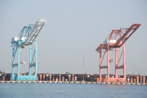
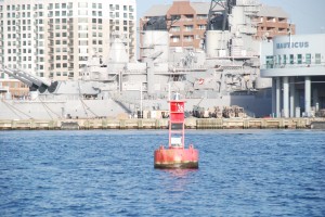
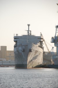
We motored past Norfolk after waiting 15 minutes for a cruiseship to leave the dock. It needed the full width of the channel to maneuver. We took a picture at mile marker “0” and we were on our way. The ICW is known for its shallow depth, bridges, and locks. It is quite narrow at times and contains bodies of water such as the Albermarle Sound, which is large and shallow, creating choppy and confused seas that can stop boats in their tracks for days. You might be wondering why we have chosen this route, with names like Alligator River and The Dismal Swamp? Apparently, as awful as this route is, it is way less daunting than going “outside”, in the Atlantic Ocean. I’m still not sure why, since we sailed 270 miles through the ocean to get to the Delaware Bay and we are about to sail TWELVE HUNDRED miles through aforementioned ocean to get to the BVI’s. But the ICW it is.
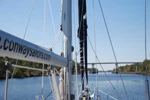
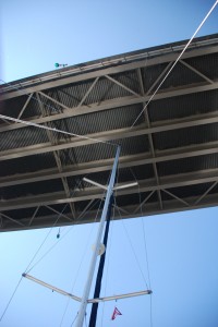
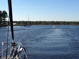
Before docking for the night, we went under 8 bridges and through one lock. Some of the bridges are fixed and have a vertical clearance of 65 feet. Our boat needs 62 feet of vertical clearance, so we basically held our breath going under those ones. The other bridges are closed and you have to hail the bridge operator on the VHF to request an opening. One bridge only opens on the half hour, so we had to wait around in neutral for about 20 minutes for that one. While we were waiting, Chris whipped up some lemon chicken with rice and peas. I ate standing up at the helm, trying to keep a 47 foot sailboat from moving around. We wound our way down the ICW, under the bridges, past all the buoys, and constantly checking our paper charts, our iPhone charts, our laptop charts, and our chartplotter, which is built into the boat. The dredged channel in some areas was extremely narrow and we had very little margin for error. If we veered off course for even a few feet, we could find ourselves grounded in four feet of water (we need 5’ 7” of depth).
By the way, this youtube video is crazy. A boat with an 85 foot mast had to get under the 65 foot fixed bridge. See how he did it. Tell me you don’t watch it and think, “This guy has b—s.”
http://www.youtube.com/watch?v=kiv0fxFcV3I
Due to the delays from the cruiseship and the one bridge, we didn’t get to the locks until it was dark. If you aren’t familiar with locks, they are a system where one body of water is dammed into two parts so that one side can have a higher level of water than the other. In order for boats to get from one side to the other, a middle “room” is made, with swinging doors on each side. One set of doors is opened and the boat enters and ties up to the side. The doors are closed and water is pumped into the “room” to bring the water level up to that of the other side. Then the opposite doors are opened and the boat can leave. Boats coming the other direction do the same thing except that the water is drained from the “room”. Don’t ask me why they have to have the water at two different levels. I have no idea.
Well, we have never gone through locks in our boat, so we were pretty nervous. I have been through locks many times. I lived on a boat on the Shinnecock Canal in Hampton Bays (Long Island, NY). There is a lock system on that canal as well. The only trouble is I was about 16 years old the last time I went through. Not exactly fresh in my mind. The fact that it was pitch dark out didn’t help. I guess that was poor planning.
We approached the 4 red lights ahead, which was all we could see, and had no idea what to do next. So we hailed the lock operator on the VHF and I just admitted that we didn’t know what we were doing and we needed help. Please. Thanks. The operator was very friendly and came down to help us tie up alongside. The whole place was lit up with lots of floodlights, so it ended up being easy, fun and exciting. The lock operator even called ahead to the next bridge to let that operator know we were coming and needed the bridge to be lifted. He also told us that we could tie up on the pier just past the bridge and stay for the night for no charge. Yay!
We went under the bridge, stopping up Saturday night traffic on the highway for about a mile, and pulled up to the pier. We tied her up, went inside, and I couldn’t believe how tired I was. I had to lay down for ten minutes before I could even think about what else we needed to do. We got the kids to bed, Chris started working on the head, I did the dinner dishes, and then I decided that I had hit a wall. Tangier Island to the Great Bridge Bascule Bridge in one day. Holy Smokes.
The next morning, Chris and Bryson started up the engines early and we were on our way before the rest of us woke up. We had a full day ahead on the ICW, including many more bridges and the dreaded Albermarle Sound. The wind was looking after us and we were running with the current all day. With the current and the wind behind us in the Albermarle, the waves didn’t act up and we sat back and enjoyed the sunshine, being careful not to look down, else we be reminded of the mud brown water below us.
By evening, we had made it to the Alligator River Bridge. We decided to stay at the Alligator River Marina, due to the glowing reviews they gave themselves in the cruising guide. Oh, and the fact that this was the only place to get fuel before we hit my mom’s house. We got diesel, tied up the boat, took showers, and headed to the Restaurant, which just so happens to be attached to the Gas Station and the Convenience Store. We all chose to have the “Country Fried Chicken”, which the menu claimed was “worth the extra wait”. I’m not sure what possessed us to do this since it had taken 15 minutes just to get our menus. I think the waitress was also the chef and the checkout person at the convenience store. I would not be surprised if she was also outside pumping gas in between customers. The kids and I amused ourselves by going “shopping” at the convenience store while we waited for our food, assuming that we would be waiting awhile. Chris wanted circus peanuts, but we couldn’t find any. Here’s what we did find:
- T-Shirts featuring the Guist Brothers from Swamp People
- Box wine on the same shelf as the motor oil and cleaning supplies
- All the beef jerky you could imagine
- “Souveniers” from the Alligator River (such as baby sharks preserved in formaldehyde, “displayed” in glass containers)
- Pork Rinds, Little Debbie Cakes, devil dogs, Sno Balls, etc, etc. But no circus peanuts.
We finished our dinners and went right to bed, tired as the dickens. At midnight, the security alarms started blaring from the Restaurant/Gas Station/Convenience Store. Being as we were 7 miles from “town”, it was awhile before we had quiet again. We decided to lock the door.
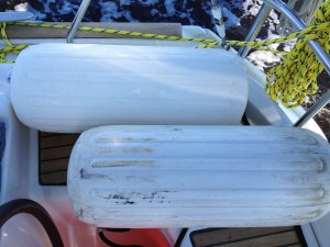
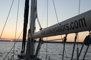
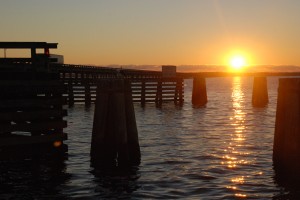
Up again early, and we were the first ones out of the marina, followed closely by two decrepit sailboats that looked like they had been around the world six times. We called to have the bridge opened for us as we motored towards the sunrise. Another long day lay ahead. We had to go 70 miles to get to Mile Marker 155, which is where Campbell Creek veers off of the ICW towards their house. The day went on and on, but we got lots of schoolwork done and I spent every minute on watch scrubbing our fenders. I have tried every vinyl cleaner and fender cleaner out there, but it turns out that Black Streak Remover is the magic potion. You know. In case you are having similar fender issues.
In two spots, the dredged channel was so narrow that our depth sounder made our hearts pound as we watched it plummet, not realizing we had veered out of it. It was strange to be in a river that was ½ a mile wide and only be able to stay in the middle, with about 10 feet of error on each side of the boat. We learned not to hug the marks, but to stay directly in the center of the channels at all times. At one point, the sounder said “6.2”. Not possible since we draw 6’ 7” empty. But we didn’t run aground. Knock on wood.
As we approached Campbell Creek, we radioed ahead to Mike and Kathy Orr (my mom and Sal’s neighbors, whose names are so similar to our Ho-Ho-Kus friends, Mike and Kathy Orbe). Mike and Bill Garrison came out on Bill’s fishing boat to guide us into the canal, which is off our chart and very shallow in places. We felt like superstars, getting our own private escort up the creek. We would have enjoyed it more if Chris and I weren’t holding our breath, waiting any moment to run aground. But we didn’t. Knock on wood.
We tied up easily at the Orr’s dock, right next to their sailboat, s/v Braveheart. We welcomed them aboard and shared sailing stories for awhile before we had to finish cleaning up and packing up some clothes for the kids, who would be sleeping at Gma and Gpa’s house. We made it, but we were too pooped to celebrate. I refuse to acknowledge that we will eventually have to leave here and continue on in the ICW. Welcome to the Hotel California…


Wow that sounds like some amazing trip. Can’t wait to hear about the rest of the I-C-W! Now I know why my in-laws had so many good stories on their cruise last year down the ICW. Good luck with the rest of your trip. I’m reading this on Sunday Nov 4th, the day I think you said you were leaving so safe travels! :)
I just lost my appetite, I can’t believe the guts you and Chris have. Please don’t rub it in when you arrive in the Caribbean. We are sitting at home, day six with no power and a nor’easter on the way. Filling up our gas containers to run our little generator so we can take a shower and flush our toilets is a three hour wait in line.
I could use a little sunshine and piña colada about now.
Good luck on your trip, can’t wait to hear from you :)
Love you all!!!!
OMG….is this stuff Dave and Lana will be experiencing? They have to get the boat first…the survey is tomorrow….gas is scarce and they want to be back in RI Tuewsday to vote! And gas is distributed on an odd/even plate number system….odd on odd days, even on even days in NJ….well they have an even plate and tomorrow is the 5th…soooo? We offered our Chrysler if need be to get home!! Hope the survey goes well!! Keep up with safe a voyage…